INTRODUCTION
This ‘Across London Visual Marathon’ section takes you through scenic riverside views and parks around the Royal Victoria Dock.
This is a summary of this blog post at Photoruns.com which has 50 self-guided routes around London. London Photoruns is to provide self-guided tours of some of London’s most iconic, photographic, and visually interesting locations that are easy to use and fun to run or walk. I will add one of these to this WordPress site – I hope you enjoy them.
Use this video to get an overview of the route and the information you need to get the most out of this Photorun without getting lost.
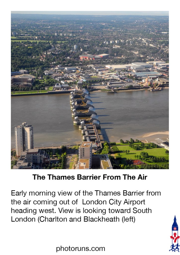
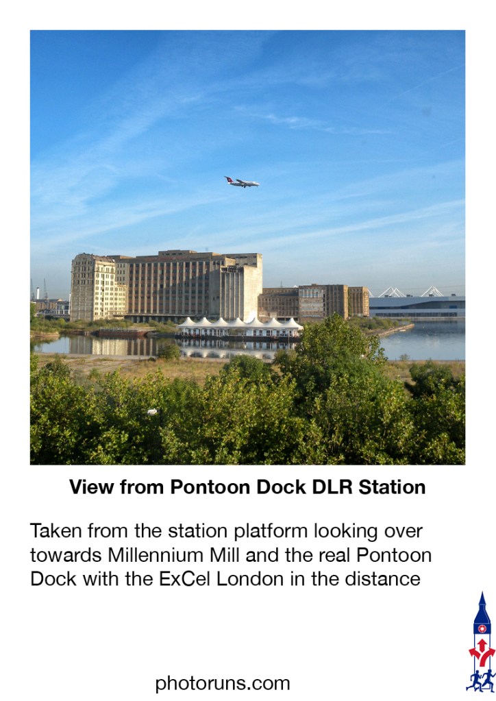
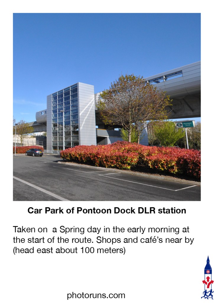
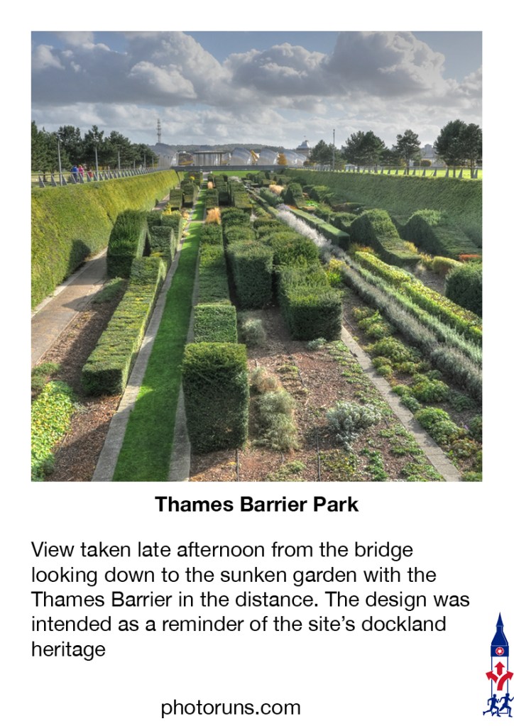
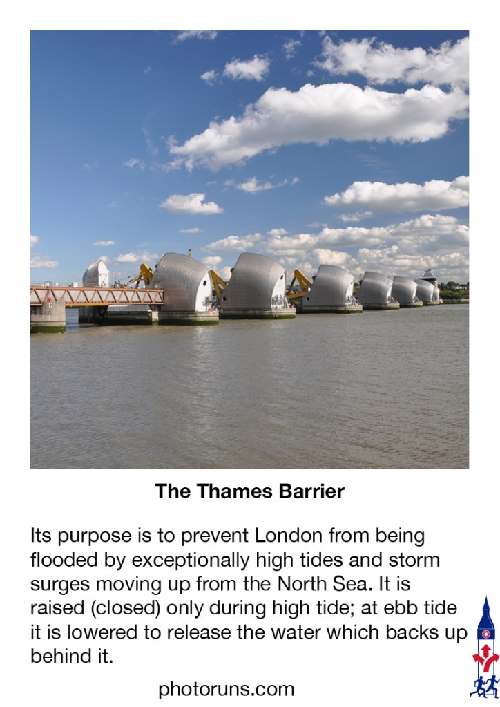
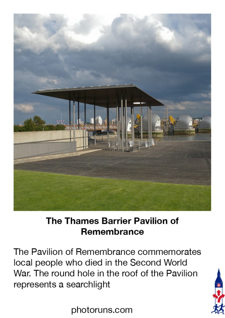
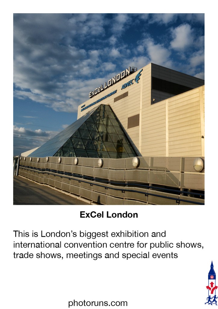
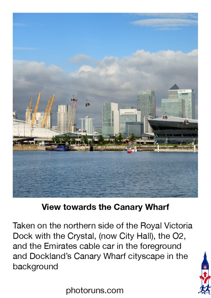
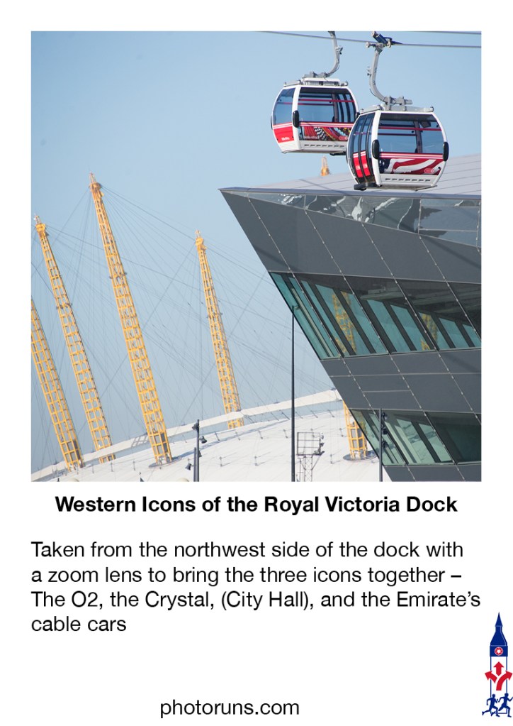
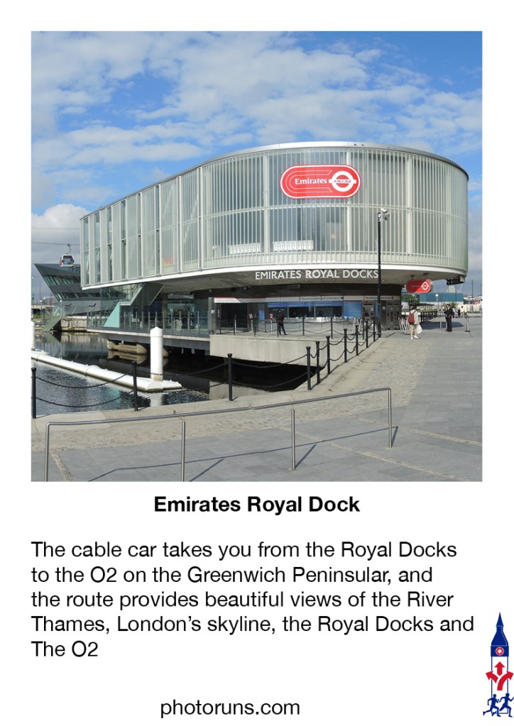
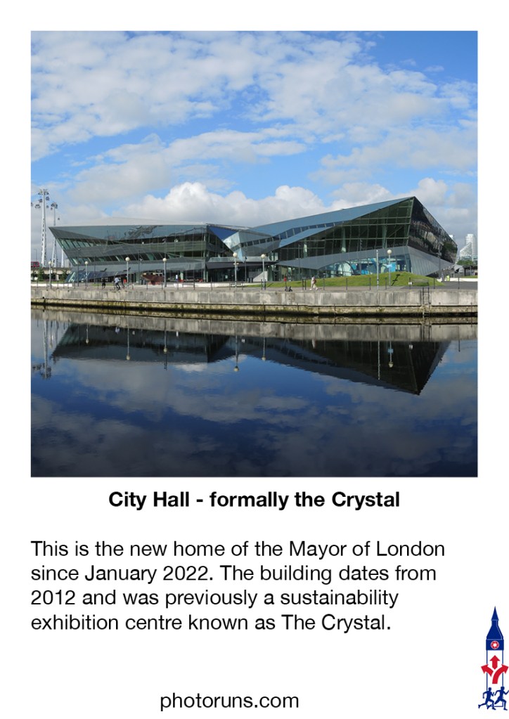
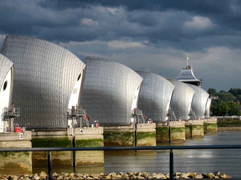
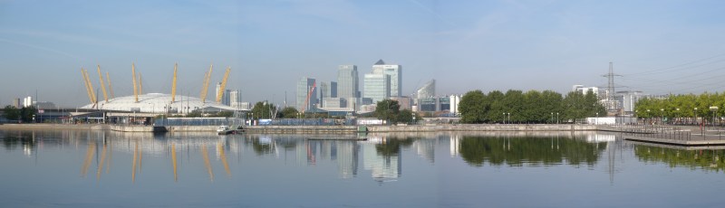
Part 1 goes from Pontoon Dock DLR (near the Thames Barrier) to the Royal Victoria Dock DLR and is about 3 Km long. It is both scenic and quiet. The route takes you to the Thames Barrier Garden, the Thames Barrier, the Royal Victoria Dock, the ExCel London, the IFS Cloud Cable Car, and the new City Hall.
The Best Time
The best time to do this run is first thing in the morning – any day of the week. The area around the Excel can get busy, but it’s an excellent place to stop for refreshments and to admire the dock views.
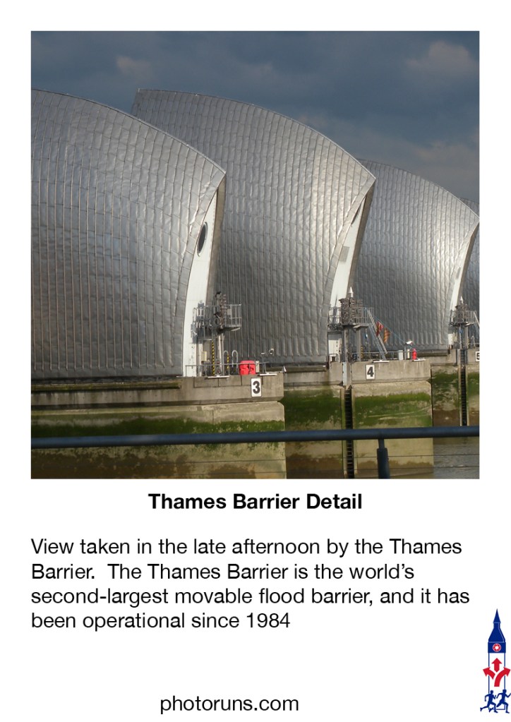
LOCATION – Thames Barrier to Royal Docks
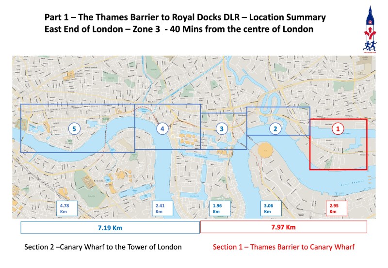
As the map shows, this is part 1 of the 14 parts of the Across London Visual Marathon, which starts at the Thames Barrier (part 1) and ends at Hyde Park Corner in the West End of London in part 14. This shows the first five parts, which start at the Thames Barrier and end at the Tower of London.
It’s a flexible marathon designed to let you choose which parts you want to do and when so you can do as little or as much as you want at any one time. These photorun blogs are more about the place than the pace, where creative fun is more important than a fast run.
ROUTE
This is a more detailed map and summary of the route.
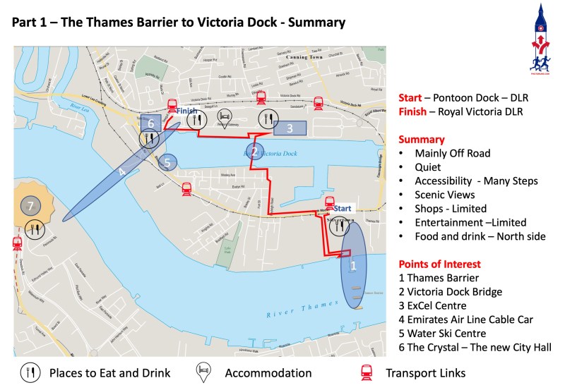
Start at Pontoon Dock DLR station and finish at Royal Victoria Dock DLR Station.
GETTING TO KNOW THE AREA – HIGH-SPEED VIDEOS
The Google map and the summary video are useful to have open when doing these Photoruns. They will help you remember the route and prevent you from getting lost.
Route at a Glance Video.
This short video (2:31 minutes) gives a quick overview of the route and the sights and then shows you what the route would look like if you were running it at about 25 mph. It’s a great way of getting familiar with the route before you do it for real.
VIRTUAL TOUR OF THE AREA
Click on the maps below and go on a virtual tour of the shopping area.
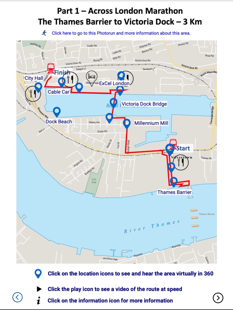
Take a virtual tour of the area and see it virtually in 360. Just click on the location icons on the map, and you will be transported to the location. You can then look around and get a sense of space and place before you experience it first-hand.